Playgrounds in Bern with drinking fountains and toilets
Playground, water, toilet: only with all three is it enough for a whole afternoon outside. Spielplatz plus shows them to you at a glance.

How it works
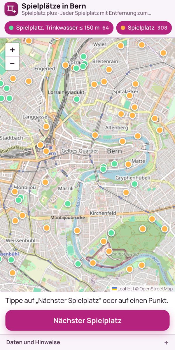
- At the top there are two groups: “Playground, drinking water ≤ 150 m” and “Playground”. If you only want to see playgrounds with water nearby, tap “Playground” to hide that group.
- Tap “Nearest playground” (Nächster Spielplatz). The app shows the walking route with the walking time in minutes.
- Tap a point: you see the distance to drinking water and a toilet.
What do the colours mean?
Green playgrounds have drinking water within 150 metres, the others are orange. The distances to drinking fountains and toilets are straight-line distances, the walk is usually a little longer. Tapping a point shows the name, if recorded, for example Spielplatz Dählhölzli, Spielplatz Monbijoupark or Spielplatz Rosengarten.
Why the combination?
The city knows its playgrounds. But parents need a playground, water and a toilet together, so they do not have to go home in between. That is why the map works out the distances in advance from three datasets: playgrounds, drinking fountains and toilets.
Where does the data come from?
From OpenStreetMap. “Route” opens the route in Google Maps, “Route in OSM” in OpenStreetMap. No tracking: only the routing service gets your location for the walking route. If a playground is missing, you can add it in OpenStreetMap.
Also worth reading
Free drinking water in BernArticleBarrierefrei BernToolKühl & warmToolText: Richard Červenka, Bärn Kit. Found a mistake? Write to hallo@uebrig.ch.